TL;DR
California is under multiple weather alerts as back-to-back winter storms, fueled by atmospheric rivers, bring dangerous flooding, mudslides, high winds and Sierra Nevada blizzards, disrupting Christmas week travel and prompting state and local emergencies.
Why This Matters
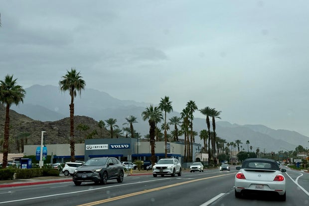
This latest storm sequence hits one of the country’s largest states at one of the busiest travel times of the year. Tens of millions of people live in the affected areas, and millions more pass through California’s airports, highways and rail lines during Christmas week, meaning local weather quickly becomes a national travel story.
Long, moisture-rich systems known as atmospheric rivers are dropping far more rain and high-elevation snow than California typically sees in late December. That raises the risk of flash flooding, mudslides and debris flows, especially where wildfires burned away vegetation earlier in the year. Steep canyon communities and coastal hillsides are particularly vulnerable.
Beyond the immediate danger, storms like this test aging infrastructure, from storm drains and levees to power lines and mountain passes that keep food, fuel and goods moving. Federal and state scientists say a warmer atmosphere can hold more water vapor, which can intensify heavy-rain events, making planning and preparedness increasingly important for residents, businesses and local governments.
Key Facts & Quotes
California Governor Gavin Newsom has declared a state of emergency for Los Angeles, Orange, Riverside, San Bernardino, San Diego and Shasta counties, allowing officials to activate emergency powers and pre-position resources, according to the governor’s office.
Storms began moving in late Tuesday and are expected to intensify into Christmas Eve, with several atmospheric rivers forecast to sweep across the state, the National Weather Service (NWS) said. Atmospheric rivers are long, narrow bands of concentrated water vapor that can deliver extreme rain and snow when they hit land, according to the National Oceanic and Atmospheric Administration.
In Southern California, forecasters say many areas could receive 4 to 8 inches of rain this week, compared with a typical half-inch to 1 inch for this time of year. Wind gusts over 60 mph have already been recorded in Los Angeles County, and parts of the central coast could see gusts of 60 to 80 mph.
A major winter storm is set to impact Southern California over the Christmas holiday, with forecasters warning of heavy rain, flooding, and travel disruptions.
Here is when the heaviest rain arrives: https://t.co/ranigfGTLt pic.twitter.com/LeMBnS4PYt
— KTLA (@KTLA) December 22, 2025
“If you’re planning to be on the roads for the Christmas holidays, please reconsider your plans,” Ariel Cohen, an NWS meteorologist in Los Angeles, said at a briefing, warning that accumulating rainfall could lead to “increasingly dangerous and life-threatening conditions.”
Los Angeles County officials report evacuation warnings and door-to-door notifications for roughly 380 especially vulnerable households near burn scars from recent wildfires, where flash flooding and debris flows are a top concern. “The threat posed by this storm is real and imminent,” Los Angeles Police Chief Jim McDonnell said, urging residents in at-risk zones to leave when told.
Local authorities have installed concrete barriers known as K-rails around some burn scars and are offering free sandbags. The state has deployed extra first responders along the coast and in Southern California, with the California National Guard on standby.
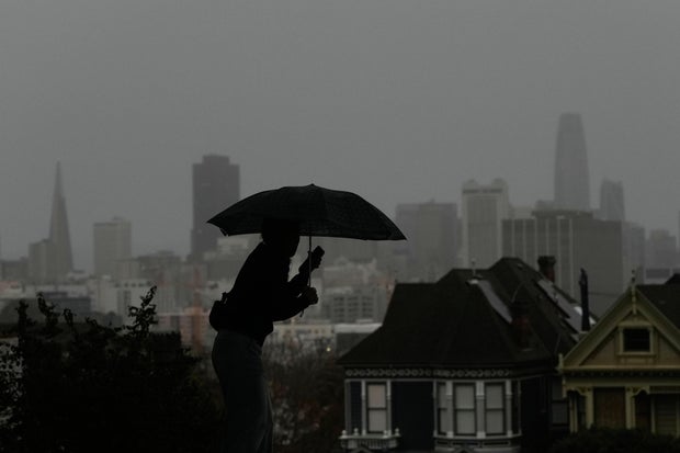
In Northern California, much of the Sacramento Valley and San Francisco Bay Area are under flood watches and high wind warnings. Heavy snow and strong gusts are expected to create near white-out conditions in parts of the Sierra Nevada, making travel over major mountain passes “nearly impossible,” the NWS said. Officials report water rescues and at least one storm-related death in the north, and Shasta County has also declared a local emergency to support flooding and rescue operations.
Forecasts also include a risk of severe thunderstorms and a small chance of tornadoes along portions of the northern coast as the storm system evolves.
What It Means for You
For people in California, the immediate takeaway is practical: check local forecasts frequently, follow evacuation orders, and avoid driving through flooded roads or during peak wind and rain when possible. If you live near a hillside, creek, or burn scar, consider sandbags and have an overnight bag, medications and key documents ready to go in case you need to leave quickly.
Holiday travelers, even outside the state, may feel the ripple effects. Major hubs in Los Angeles, San Diego, San Francisco and Sacramento may see delays or cancellations that spread through the national air network. If you’re flying, monitor airline alerts and build extra time into connections.
Longer term, events like this underscore the value of preparing for severe weather in any season: reviewing insurance coverage, knowing your local evacuation routes and checking on older relatives or neighbors who may need help during storms.
Sources: California Governor’s Office emergency proclamation (Dec. 23, 2025); National Weather Service and National Oceanic and Atmospheric Administration updates for California (Dec. 23-24, 2025); Public statements from Los Angeles County and Shasta County emergency officials (Dec. 23-24, 2025).
Question for readers: How do you decide when to change or cancel travel plans because of severe weather warnings?